Grand Canyon to Bryce Canyon and Zion National Park Road Trip Itinerary
There is no shortage of national and state parks, monuments, and landscapes to explore in the Southwest.
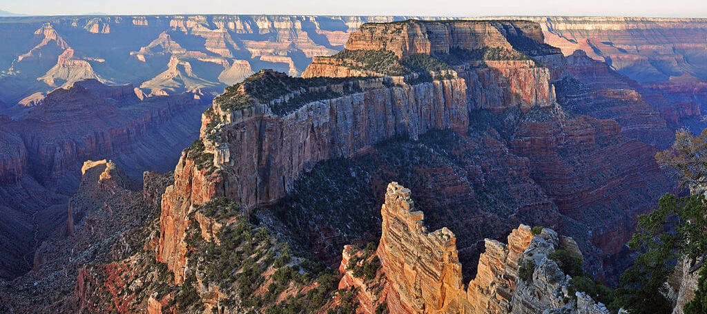
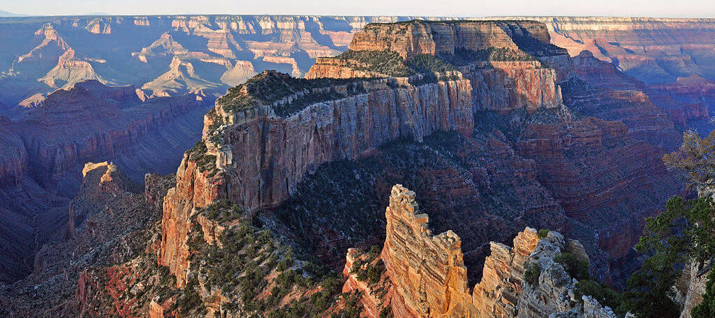
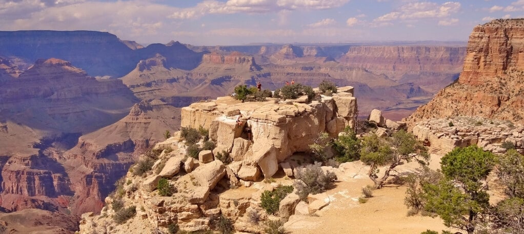
While the Grand Canyon is certainly one of the most popular spots—nearly five million people visit the South Rim National Park alone each year—there are two other National Parks within a proverbial stone’s throw of the Grand Canyon that Southwest roadtrippers often add to their itineraries: Zion National Park and Bryce Canyon National Park.
These three Southwest hotspots are ideally situated for a convenient road trip loop, making this journey particularly ideal for travelers exploring the region in a rented car. See them all—with some other state parks and national monuments thrown in for good measure—on our Ultimate Grand Canyon-Bryce Canyon-Zion National Park road trip.
The Ultimate Grand Canyon to Zion National Park and Bryce Canyon Road Trip Itinerary
Thanks to its close proximity, ease of access, and abundant amenities, Las Vegas is an ideal homebase for our Ultimate Grand Canyon to Zion National Park and Bryce Canyon road trip itinerary.
Route Summary
- Las Vegas → Grand Canyon South Rim National Park → Grand Canyon North Rim National Park → Grand Canyon East and Page, AZ → Kodachrome Basin State Park & Grand Staircase-Escalante National Monument → Bryce Canyon National Park → Zion National Park → Valley of Fire State Park → Las Vegas
Total Miles Travelled: 1,083 miles (starting and ending in Las Vegas)
Total Driving Time: 20 hours
Recommended Trip Duration: 5-7 days
Route map
Because it’s a loop, this route can easily be reversed. Instead of following our suggested Grand Canyon-Bryce Canyon-Zion National Park loop, you can also start your trip at Zion, then make your way to Bryce Canyon and the Grand Canyon National Park before returning to Las Vegas.
Let’s hit the road!
Las Vegas
Route Summary
- Las Vegas → Grand Canyon South Rim National Park → Grand Canyon North Rim National Park → Grand Canyon East and Page, AZ → Kodachrome Basin State Park & Grand Staircase-Escalante National Monument → Bryce Canyon National Park → Zion National Park → Valley of Fire State Park → Las Vegas
Over 43 million people visit Las Vegas every year. Despite its rambunctious reputation, Las Vegas is a fantastic homebase for your Southwest explorations, offering easy access to nearby attractions like Red Rock Canyon and Death Valley, as well as ample accommodation options and in-town activities for travelers of every inclination, including kids.
If you have a few days to explore Las Vegas, check out our Ultimate Guide to Visiting Las Vegas for our tips for finding the right hotel, what to pack, where to eat, and what else you can see and do in the city limits and beyond.
Grand Canyon South Rim National Park
Route Summary
- Las Vegas → Grand Canyon South Rim National Park → Grand Canyon North Rim National Park → Grand Canyon East and Page, AZ → Kodachrome Basin State Park & Grand Staircase-Escalante National Monument → Bryce Canyon National Park → Zion National Park → Valley of Fire State Park → Las Vegas
EXPAND MAP
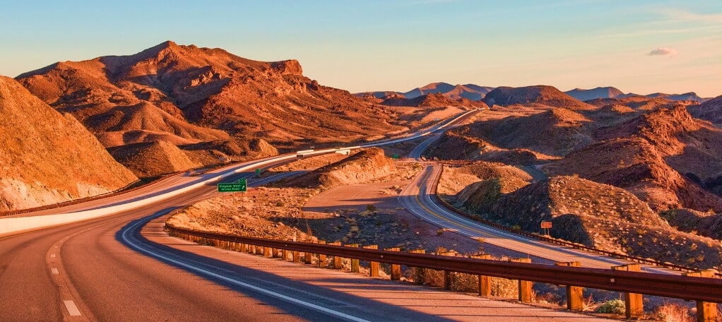
The Grand Canyon’s South Rim National Park is about 281 miles from Las Vegas—a drive of roughly 4-5 hours. If you are starting your Grand Canyon to Zion National Park road trip at the South Rim, your route from Las Vegas will take you along historic Route 66, with stops at the Hoover Dam, Kingman, and Seligman, AZ on the way:
- Hoover Dam: Just a quick 40 miles from Las Vegas, the Hoover Dam is well worth a stop to snap a pic of Lake Mead, the Dam, and the Bypass Bridge. The Hoover Dam is not directly en route to Las Vegas from the North Rim, so if you’re heading in that direction or you want to explore deeper into the Hoover Dam, you might be better off making a separate trip or taking a guided Hoover Dam day tour from Las Vegas.
- Kingman: Kingman has over 60 restaurants to choose from, including the famous Mr. D’z Route 66 Diner (try their famous homemade root beer). It’s also a great place to stop for the night if you want to break up your long drive from Vegas to the South Rim.
- Seligman: This small highway town only has 500 inhabitants, but it’s the perfect place to stretch your legs and stock up on supplies. Check out the Route 66 General Store and the Return of the 50s Museum, and stop in at the Roadkill Cafe to try one of their famous buffalo burgers.
The South Rim is the most popular place to visit the Grand Canyon, with the greatest available amenities, the highest concentration of viewpoints and hiking trails, a robust schedule of guided Ranger programs and events, and a number of dining and accommodation options. Here are some highlights to keep in mind:
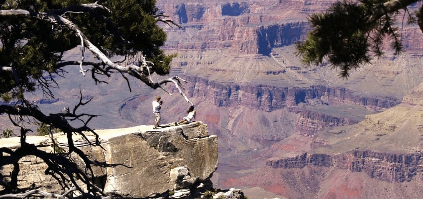
- Viewpoints: There are nearly two dozen viewpoints to check out at the South Rim, including Mohave Point (popular at sunset), Mather Point (see nearly ¼ of the entire Grand Canyon!), and Desert View. Discover more South Rim viewpoints on our blog.
- Hiking: Bright Angel Trail is the perfect single-day hike into the Canyon. If you want an easier walk, are biking, or are visiting with young kids, try the Rim Trail instead.
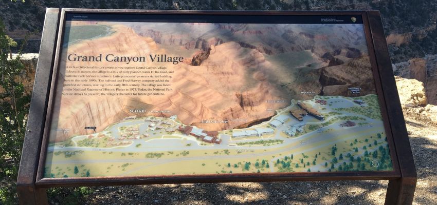
- Grand Canyon Village: Check out ranger programs, grab a souvenir, and see the most historic Grand Canyon structures, including Hopi House, Lookout Studio, and Bright Angel Lodge. Learn more about the Grand Canyon Village.
Check out our South Rim resources to learn more about what you can see and do while you visit:
Grand Canyon North Rim National Park
Route Summary
- Las Vegas → Grand Canyon South Rim National Park → Grand Canyon North Rim National Park → Grand Canyon East and Page, AZ → Kodachrome Basin State Park & Grand Staircase-Escalante National Monument → Bryce Canyon National Park → Zion National Park → Valley of Fire State Park → Las Vegas
EXPAND MAP
Though they are less than a mile apart as the crow flies, the Grand Canyon’s North Rim is a 211 mile, 4 hour drive from the South Rim National Park. If you’re thinking about skipping the busy South Rim, you can head straight to the quiet North Rim from Las Vegas—it’s about the same driving distance from Las Vegas and Page, AZ (the next stop on our itinerary) as the South Rim.
If you have enough time, it’s certainly possible to visit both Rims during your National Park adventure. If you only have time to visit one Rim, our guide can help you decide which spot to visit.
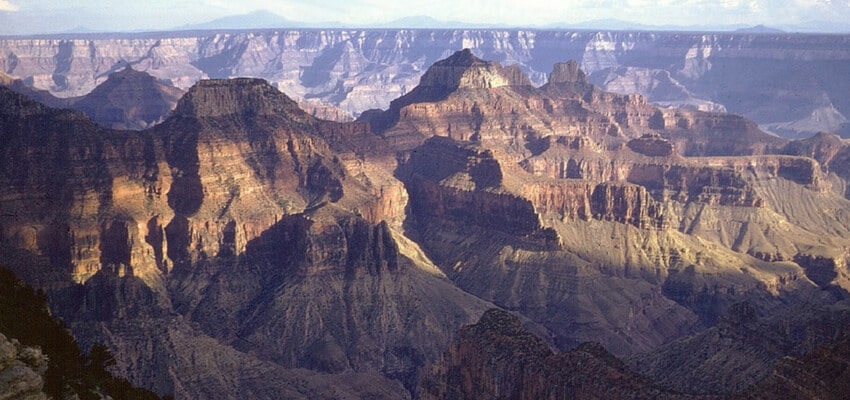
Both regions offer very different experiences. The North Rim receives significantly fewer visitors than the South Rim—about 10% of the Grand Canyon’s total visitation—and it offers a much more relaxed vibe with more natural solitude, as well as a cooler climate and a wider range of vegetation thanks to its higher elevation.
Read our North Rim guide for more information on the area, including hiking trails and viewpoints.
Grand Canyon East & Page, AZ
Route Summary
- Las Vegas → Grand Canyon South Rim National Park → Grand Canyon North Rim National Park → Grand Canyon East and Page, AZ → Kodachrome Basin State Park & Grand Staircase-Escalante National Monument → Bryce Canyon National Park → Zion National Park → Valley of Fire State Park → Las Vegas
EXPAND MAP
Page, AZ is roughly 2.5 hours from the South Rim and the North Rim. This bustling Arizona town is an ideal place to base your Grand Canyon East explorations, especially if you want to stay for a night or two. It’s within easy distance of iconic east rim views like Antelope Canyon and Horseshoe Bend, as well as Marble Canyon and Lake Powell, and there are numerous dining and accommodation options available.
Be sure to check out:
- Marble Canyon: Marble Canyon marks the beginning of the Grand Canyon at its westernmost point. You can cross its colorful rocks and cliffs on foot using the historic Navajo Bridge, which first opened in 1929. If you’re travelling by car, you’ll cross a newer companion bridge that opened in 1995.
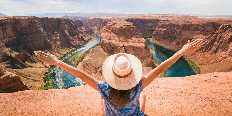
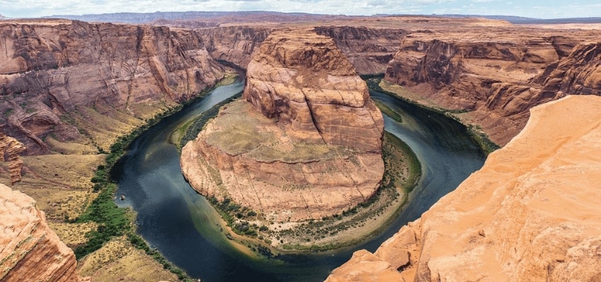
- Horseshoe Bend: About 4 miles from Page, this horseshoe-shaped meander in the Colorado River is one of the most iconic Grand Canyon viewpoints.
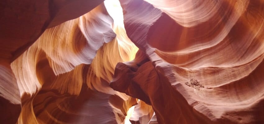
- Antelope Canyon: Antelope Canyon is a narrow slot canyon that is well known for its distinctive smooth, curved orange walls and ethereal sunbeams.
Find out what else you can see and do on the east rim of the Grand Canyon:
Kodachrome Basin State Park & Grand Staircase-Escalante National Monument
Route Summary
- Las Vegas → Grand Canyon South Rim National Park → Grand Canyon North Rim National Park → Grand Canyon East and Page, AZ → Kodachrome Basin State Park & Grand Staircase-Escalante National Monument → Bryce Canyon National Park → Zion National Park → Valley of Fire State Park → Las Vegas
EXPAND MAP
Kodachrome Basin State Park is about 170 miles—roughly a 3 hour drive—from Page, AZ. Best known for its 67 towering sand pipes, Kodachrome Basin has earned a reputation as a photography paradise—in fact, the park is such a hotspot for photographers that it was actually renamed in 1962 when the Kodak Corporation gave permission to use the name of its famous Kodachrome film.
If you have time, the main entrance for the Grand Staircase-Escalante National Monument (located in Escalante, UT) is about 50 minutes northeast of Kodachrome Basin. This National Monument is home to a mixture of colorful sandstone cliffs, narrow slot canyons, washes, and slickrock formations. With vast swathes of untouched backcountry to explore, this region is a must-see for the most adventurous among us, and is well worth a stop on your way to Bryce Canyon National Park.
EXPAND MAP
For a longer detour, you could also continue another 1.5 hours, or 70 miles (about 110 miles, or 2.5 hours total from Kodachrome Basin), north of Grand Staircase-Escalante to Capitol Reef National Park. Capitol Reef is best known for the Waterpocket Fold—a 100-mile “wrinkle” in the earth’s crust.
EXPAND MAP
Bryce Canyon National Park
Route Summary
- Las Vegas → Grand Canyon South Rim National Park → Grand Canyon North Rim National Park → Grand Canyon East and Page, AZ → Kodachrome Basin State Park & Grand Staircase-Escalante National Monument → Bryce Canyon National Park → Zion National Park → Valley of Fire State Park → Las Vegas
EXPAND MAP
Fast Facts
- Bryce Canyon National Park welcomes over 2.5 million visitors every year.
- There’s an entry fee: $35 per private vehicle, $30 for motorcycles, or $20 for those entering by foot or bicycle.
- Bryce Canyon National Park covers nearly 35,835 acres.
Bryce Canyon National Park is just a short 23 mile drive from Kodachrome Basin.
Named after Ebenezer Bryce, a mormon pioneer who set up a homestead in the area in 1874, the Park’s major feature is Bryce Canyon. Bryce Canyon isn’t technically a canyon at all—it’s actually a collection of giant natural amphitheaters along the eastern edge of the Paunsaugunt Plateau.
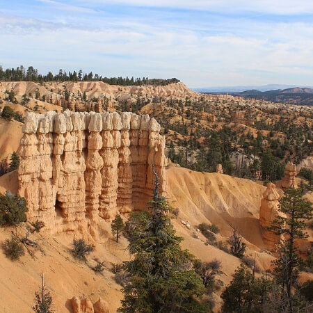
Bryce Canyon National Park is most famous for its rock spires, known as “hoodoos”. Formed by frost weathering and stream erosion of sedimentary rocks, the hoodoos are best viewed from the scenic drive along the edge of the Canyon rim, which can reach elevations up to 9,100 feet above sea level—much higher than Zion Canyon.
The park is open year round, and is popular for snowshoeing, cross-country skiing, and sledding in the winter. During the summer, visitors often stop to watch the sunrise or sunset at Bryce Amphitheater, Sunrise Point, Sunset Point, Inspiration Point, or Bryce Point. The elevation can make weather unpredictable—particularly in the winter months—and lightning is especially common, so be sure to pack accordingly.
ROAD TRIP TIP: The night sky at Bryce Canyon is one of the darkest in the country. If you can, stay overnight and sign up for a full-moon hike into the Canyon—no flashlights allowed.
NOTE: Parking is limited in the summer—there is only one spot for every four cars, so plan to arrive early, or take the free shuttle. The shuttle stops at all the main viewpoints and is the most efficient way to explore the National Park.
Hiking trails
Ranger-led night hikes, including Astronomy and Full Moon hikes where you can steal a closer look at the stars through a telescope, are very popular at Bryce Canyon National Park. There are many other hiking trails at a variety of difficult levels to enjoy as well. Here are some of the most well-traveled:
Queen’s Garden Trail
Difficulty
Length
Time
Trailhead
Easy
1.8 miles round trip
1-2 hours
Sunrise Point
The Queen’s Garden Trail is the least difficult trail into the Canyon, with a relatively short descent of 320 feet. Royal watchers in particular will relish the opportunity to see a hoodoo that bears a striking resemblance to Queen Victoria.
Mossy Cave Trail
Difficulty
Length
Time
Trailhead
Easy
0.8 miles round trip
30 minutes round trip
Just beyond Bryce Canyon Amphitheater on Highway 12 as you approach Tropic
Get a different view of Bryce Canyon on the Mossy Cave Trail, which follows a sparkling river to a cave of dripping water complete with a waterfall and vibrant green plants growing out of the red rock walls. Located in the north end of the National Park, this trail does not descend into the Canyon, making it ideal for families with children. The waterfall flows from May-October.
Rim Trail
Difficulty
Length
Time
Trailhead
Easy
3-4 hours one way; 6-8 hours round trip
Fairyland Point or Bryce Point
The Rim Trail connects many viewpoints and hiking trailheads. It can be hiked the whole way, but you may prefer to choose a couple of viewpoints to hike between and drive the rest of the way, or even add a loop trail to your adventure. Sunrise Point to Sunset Point—about 1 mile round trip—is a popular option.
Navajo Loop Trail
Difficulty
Length
Time
Trailhead
Moderate
1.3 miles round trip
1.5-2 hours
Sunset Point
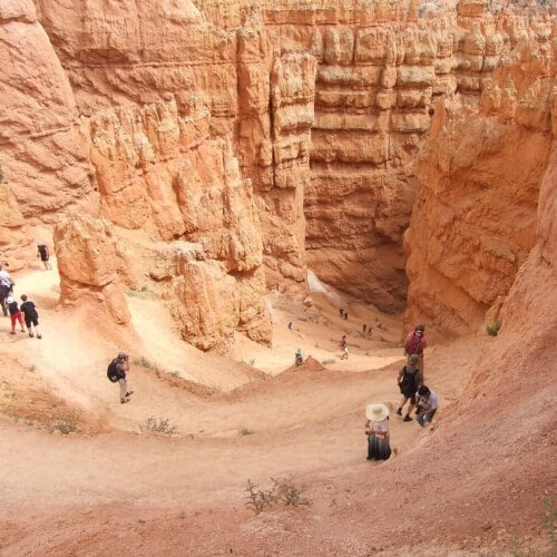
This short hike starts at Sunset Point and heads down into the Amphitheatre. See a slot canyon called Wall Street, the Silent City, stand right next to hoodoos, and pass 700-year old Douglas fir trees while you hike. The descent into the Canyon is steep, so take your time and be sure to drink lots of water on your way out.
For a longer hike, you can catch the Queen’s Garden Loop Trail on the canyon floor, as well as the Peek-A-Boo Loop.
Peek-A-Boo Loop
Difficulty
Length
Time
Trailhead
Hard
5.5 miles round trip (8.6 miles including the Navajo Loop Trail)
4-6 hours
Bryce Point
Peek-A-Boo Trail is primarily an equestrian trail, but it’s also popular among hikers. Beginning at Bryce Point, the Peek-A-Boo Trail offers one of the most breathtaking vistas in the park, including a 1,000 foot descent (and later ascent) into the canyon. The Peek-A-Boo Loop also meets up with the Navajo Loop Trail on the canyon floor to create an 8.6 mile trek that will take you past the Wall of Windows, the Cathedral, and the Three Wise Men formations.
Under-the-Rim Trail
Difficulty
Length
Time
Trailhead
Hard
23 miles one way
2 days
Bryce Point or Rainbow Point
This epic 23-mile trail will take you from Bryce Point to Rainbow Point. You’ll need about 2 days to complete it, plus a backcountry permit and a ride arranged to take you back to the trailhead (unless you want to take two more days to walk all the way back).
Fairyland Loop
Difficulty
Length
Time
Trailhead
Hard
8 miles round trip
4-5 hours round trip
Fairyland Point
The Fairyland Loop will take you from Fairyland Point into the amphitheater, where you can walk among hoodoos and deep canyons. The trail is primarily located at the bottom of the canyon, with a drop—and subsequent vertical climb—of nearly 900 feet. As a result, the Fairyland Loop can be dangerous and strenuous, and is therefore best for prepared and experienced hikers.
Viewpoints
- Sunrise Point: This easy-to-access viewpoint is can be reached via a short, light walk from the Bryce Canyon Lodge and Visitor Center. Sunrise Point prominently displays the many geographic features and landscapes visible throughout the park, including hoodoos, greenery, and “sand dunes”. Spot Thor’s Hammer, the Silent City, Boat Mesa, and Sinking Ship, as well as Limber Pine, Fairyland Canyon, and the stunning reflection of the sun on the rock formations. It’s also the trailhead for the Queen’s Garden and Fairyland Loop trails.
- Bryce Point: Bryce Point is one of the highest overlooks on the Rim, reaching 200 feet higher than Inspiration Point and offering an almost bird’s-eye view of the Park’s famous hoodoos. It also offers an unbeatable view of the Bryce Amphitheater, and is one of the best places to watch the sunrise—the morning light at Bryce Point catches the hoodoos in stunning fashion, lending them a warm orange glow. The 23-mile Under-The-Rim Trail also extends from Bryce Point in the north to Rainbow Point in the south.
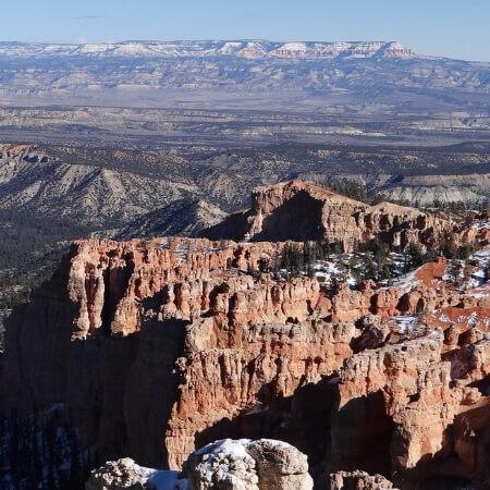

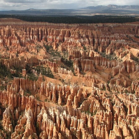

- Inspiration Point: A short trail leads to Inspiration Point, which actually consists of three viewpoints at various elevations, including panoramic views of one of the most iconic sights at Bryce Canyon—the Bryce Amphitheater.
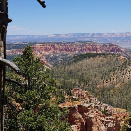
- Rainbow Point: Take in panoramic views of southern Utah—from a height of 9,100 feet—including the geological Grand Staircase rock layer, from the uppermost Pink Cliffs to red Vermilion Cliffs beyond. The best place to view Rainbow Point is from the north side, overlooking the southern rim of the amphitheater. Adventurous visitors can also hike the 7.5 mile Riggs Spring Loop Trail to see nearby Yovimpa Point.
- Paria View: Looking out over the floor of Bryce Canyon, Paria View is situated 2 miles off the south road. For sunset views, Paria Point can’t be beat—later in the day, the hoodoos catch the last rays of the sun and glow a brilliant red.
- Farview Point: Farview Point gets its name from the immense distance you can view from the overlook, with sights of a seemingly endless valley of hoodoos, slot canyons, rocky ridges, and the sun bouncing off the rock at all times of day. Farview Point offers views of many of the National Park’s most famous rock formations, including the Kaibab Plateau on the north rim of the Grand Canyon, the Pink Cliffs of the Aquarius Plateau, the grey rocks of Kaiparowits Plateau, and the white formations of Mollie’s Nipple.
- Piracy Point: Piracy Point offers similar views to Farview Point, but with additional sights of two large rock formations that resemble battleships. A short walk along an easy path leads to nearby Farview Point.
- Agua Canyon: Agua Canyon offers breathtaking views of three geological layers—hoodoos in the front, pink cliffs beyond, and Navajo Mountain on the horizon.
- Fairyland Point: Located outside of the National Park boundaries, Fairyland Point is less frequently visited. There are fewer hoodoos, but Fairyland Point offers views of a river running through the red rock on the canyon floor below, as well as parts of the Fairyland Loop trail, Sinking Ship, Aquarius Plateau, and Navajo Mountain. You can also jump on the Rim Trail at Fairyland Point.
Zion National Park
Route Summary
- Las Vegas → Grand Canyon South Rim National Park → Grand Canyon North Rim National Park → Grand Canyon East and Page, AZ → Kodachrome Basin State Park & Grand Staircase-Escalante National Monument → Bryce Canyon National Park → Zion National Park → Valley of Fire State Park → Las Vegas
EXPAND MAP
Fast Facts
- Zion National Park welcomes over 2 million visitors every year.
- There’s an entry fee: $35 per private vehicle, $30 for motorcycles, or $20 for those entering by foot or bicycle.
- The National Park is open year round, with visitation peaking between June and September.
Named by Mormon settlers after the ancient Hebrew word for “sanctuary” or “refuge”, Zion National Park is about 73 miles southwest of Bryce Canyon, near Springdale, UT.
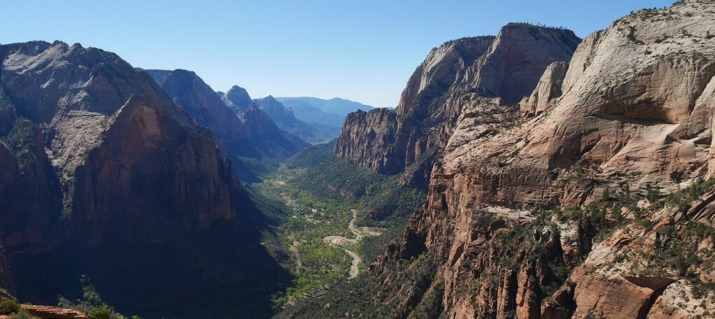
Zion National Park is located at the junction of the Colorado Plateau, Great Basin, and the Mojave Desert. As a result, the park’s geography is unique, including mountains, canyons, buttes, monoliths, rivers, slot canyons, and natural arches. It’s best known for Zion Canyon—a 15-mile long canyon that reaches depths up to 2,640 feet. Unlike the Grand Canyon and Bryce Canyon, Zion Canyon is typically viewed from the canyon floor—instead of peering over the canyon rim into deep rocky chasms, you’ll be peering upwards at massive granite cliffs.
Travellers that would prefer not to park inside the National Park can catch the shuttle bus in Springdale. The shuttle is free, and will drop you off at eight different stops within the park.
ROAD TRIP TIP: Arizona does not observe daylight saving. After you cross the border, double check your timezones so you can adjust your clocks accordingly and stay on schedule.
If you have limited time, you may want to plan your road trip itinerary so that you spend more time at Zion National Park than Bryce Canyon. One night is more than enough time to experience Bryce Canyon, but the many hiking trails, viewpoints, and activities at Zion National Park will keep you occupied for several days.
Hiking Trails
From easy, family-friendly walks to multi-day backcountry excursions, Zion National Park is a hiker’s paradise. Here are some of the most popular trails:
Riverside Walk
Difficulty
Length
Time
Trailhead
Easy
2.2 miles round trip
1.5 hours
Temple of Sinawava (9th shuttle stop)
Starting at the end of the Zion Canyon Scenic Drive, the Riverside Walk is a leisurely two-mile walk that’s a great low impact alternative to the Narrows. It’s perfect for a picnic, with lots of opportunities to stop and snap pics of the surrounding scenery. The river is also shallow enough for children to play, making the Riverside Walk an ideal adventure for families with children.
Pa’rus Trail
Difficulty
Length
Time
Trailhead
Easy
3.5 miles round trip
2 hours
Zion Canyon Visitor Center
This 3.5 mile trail travels along the Virgin River from the South Campground to Canyon Junction. It’s paved and suitable for wheelchairs, and dogs are welcome.
Canyon Overlook Trail
Difficulty
Length
Time
Trailhead
Easy to moderate
1 mile round trip
1 hour
Highway 9 just east of the Mount Carmel Tunnel
The Canyon Overlook Trail is a lighter, shorter alternative to the popular Angel’s Landing trail. A short 1-mile round trip hike with a 163 foot elevation gain, this trail brings you to a fantastic high-elevation overlook without the difficult final ascent of Angel’s Landing.
BE ADVISED: The parking area is very small and can get congested, so try to arrive early in the day if you can.
Lower Emerald Pool Trail
Difficulty
Length
Time
Trailhead
Moderate
1.2 miles round trip, up to 3 miles if you continue to the Upper Emerald Pool
2-4 hours
Zion Lodge (5th shuttle stop) or The Grotto (6th shuttle stop)
Starting at Zion Lodge, this 1.2 mile paved trail leads to a waterfall you can actually walk behind at the Lower Emerald Pool. If you’re looking for a more rugged hike, the Lower Emerald Pool Trail connects to the more intense Kayenta and Upper Emerald Pool Trails. Swimming is not permitted.
Angel’s Landing
Difficulty
Length
Time
Trailhead
Hard
5.4 miles round trip
3-5 hours
The Grotto (6th shuttle stop)
The Angel’s Landing trail is the most famous hiking trail at Zion National Park. The trail starts by following the West Rim Trail leading to Scout’s Lookout. From here, you can decide whether you want to brave the final 1-mile climb along the narrow canyon spine. Be warned—if you’re afraid of heights, exposure, or crowds, you may want to skip the final leg of this trail.
The hike to Angel’s Landing includes 2.7 miles of steep, one-way uphill climbing. It’s not ideal for young children. For the best experience, give yourself a full day to do the round trip. If you want to beat the crowds, try to arrive early in the day.
The Narrows
Difficulty
Length
Time
Trailhead
Hard
5-10 miles
As long as you want, up to several hours
Temple of Sinawava (9th shuttle stop)
Take the Riverside Walk till it ends to catch the Narrows trail. This trail actually follows the Virgin River, which means you’ll be walking through knee to waist-deep water, so be sure to dress appropriately and wear waterproof footwear. Don’t let the thought of wet feet put you off — it’s worth it to see the walls of sandstone stretch as high as 2,000 feet above you.
The Narrows can be as long or difficult as you like—simply follow the Virgin River as far as you want, then turn back. Day hiking is permitted if you start from Riverside Walk and are not going any further than Big Spring (5 miles). If you want to continue past Big Spring, you’ll need a backcountry permit.
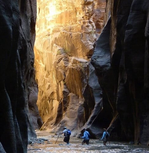
NOTE: Winter runoff means this trail usually doesn’t open till June or July.
Rent a Bike
Rent a bicycle from one of the many rental outposts near Zion National Park to ride the Pa’rus Trail or wind your way along the Zion Canyon Scenic Drive.
ROAD TRIP TIP: The shuttle buses that run in the park have bike racks on the front, so you can take the bus one direction to the end of the Scenic Drive and bike back at your own pace.
You can also book guided bicycle tours in nearby Springdale.
Mount Carmel Highway
The Mount Carmel Highway stretches for 21 miles, connecting the south and east entrances of the National Park. This scenic drive features up and down steep switchbacks, numerous pull-offs and photo opportunities, and a trip through the 1.1 mile long Zion-Mt. Carmel Tunnel.
Be sure to allow extra time for delays to stop at the many photo ops along the route, and to accommodate other large vehicles traversing the Tunnel—the Tunnel reduces to one lane to accommodate vehicles like RVs, and delays up to 15 minutes are common. For more information on large vehicle restrictions, visit the National Park Service website.
NOTE: There are no washrooms or other services along the route, so be sure to stop for a washroom break before you begin your journey. Bring all the food and water you’ll need for your journey.
Beyond the scenic highway, driving in Zion National Park is restricted for much of the year. From mid-march through November, your only option for transportation within the park is the shuttle. The shuttle is free, and departs from the Springdale Visitor Center.
Viewpoints
- Towers of the Virgin: Located behind the Zion Human History Museum, the Towers of the Virgin are viewable from second shuttle stop. This is a popular spot for watching the sunrise or sunset.
- Court of the Patriarchs: Get off the shuttle at the 4th stop, between Canyon Junction and Zion Lodge, to spot three prominent sentinels named after Abraham, Jacob, and Isaac.
- Weeping Rock: Disembark the Park shuttle at Weeping Rock Trailhead (the 7th stop) and climb a short but steep 0.4 miles to reach Weeping Rock. Here, a constant drip of spring water creates a moisture-rich environment that enables cascades of hanging gardens to grow.
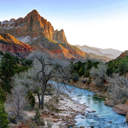
- The Watchman: Accessible via a 2-mile round trip hike, the Watchman is a popular spot to watch the sunset, and is one of the most well-known viewpoints in the park. Catch the trailhead near the Visitor Center, and spot the Towers of the Virgin, West Temple, and the Altar of Sacrifice on your way. The Watchman can also be seen from the Canyon Junction shuttle stop.
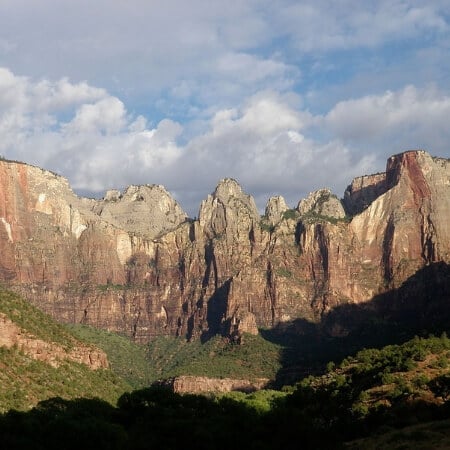

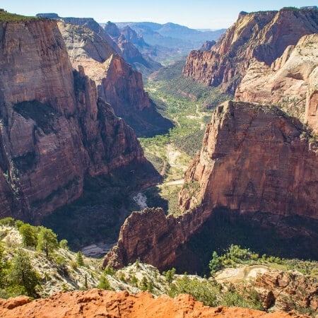

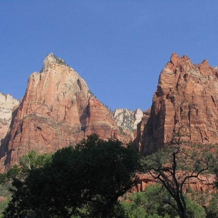
- Observation Point: Also accessible from the Weeping Rock Trailhead (the 7th shuttle stop), the summit of Observation Point lies 6,507 feet above sea level at the top of Mount Baldy. The trail is mostly paved, but with an elevation gain of 2,000 feet and a 4-mile hike each way, this viewpoint may not be accessible for those travelling with kids. If you do make the climb, you’ll be rewarded with views of the Three Patriarchs, Angel’s Landing, the majority of Zion Canyon, Hidden Canyon, and Echo Canyon.
- Big Bend: Get off at the 8th shuttle stop to see the Great White Throne and catch a view of the Angel’s Landing trail far above you.
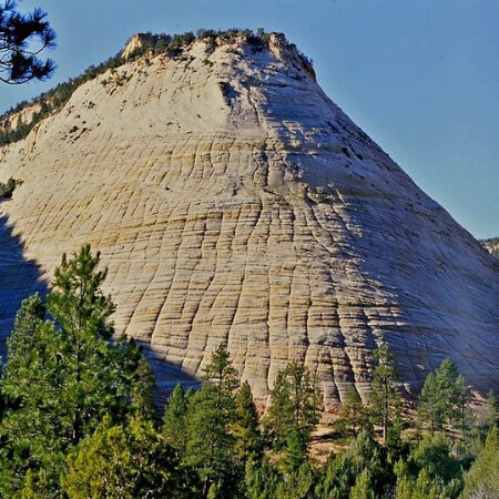
- Checkerboard Mesa: This slickrock formation is located near the east entrance of the National Park and can be viewed from a pull-off near on the Zion-Mt. Carmel Scenic Highway. Featuring a perfect checkerboard line pattern, the light gray-ish color of the rock starkly contrasts the orange layers of the surrounding mountains.
- Kolob Canyon: Located in the northwest area of the National Park—technically 40 miles away from Zion Canyon itself—Kolob Canyon welcomes significantly fewer visitors than the rest of the park. The 5-mile scenic Kolob Canyon Road winds through a quiet, rugged stretch with viewpoints to stop at along the way, as well as trailheads for backcountry hikes. Adventurous visitors will want to check out the Subway Trail, which starts from the Left Fork trailhead in Kolob Canyon. This difficult hike features 9 miles of river crossings, bouldering, and steep climbs en route to the Subway—a stunning geological feature that mimics a subway tube. The Subway itself is only about half a mile long, but access is limited and requires a permit.
Valley of Fire State Park
Route Summary
- Las Vegas → Grand Canyon South Rim National Park → Grand Canyon North Rim National Park → Grand Canyon East and Page, AZ → Kodachrome Basin State Park & Grand Staircase-Escalante National Monument → Bryce Canyon National Park → Zion National Park → Valley of Fire State Park → Las Vegas
EXPAND MAP
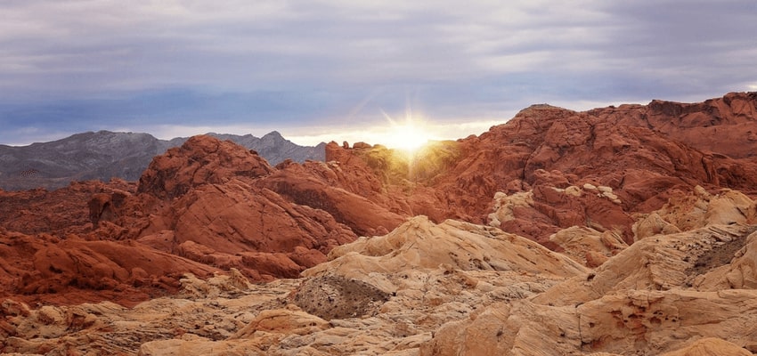
Formed over the course of 150 million years, the eponymous red rock formations of the Valley of Fire get their characteristic hue from the concentration of iron oxide in the area’s sediment.
The Valley of Fire is about 130 miles, just under 2.5 hours drive, from Zion National Park, making it the perfect place to break up your drive to Las Vegas. Stop and stretch your legs, explore the area, or enjoy a picnic before you finish your journey.
Learn more about what to see and do at the Valley of Fire:
Las Vegas
Route Summary
- Las Vegas → Grand Canyon South Rim National Park → Grand Canyon North Rim National Park → Grand Canyon East and Page, AZ → Kodachrome Basin State Park & Grand Staircase-Escalante National Monument → Bryce Canyon National Park → Zion National Park → Valley of Fire State Park → Las Vegas
EXPAND MAP
The drive to Las Vegas is just under 50 miles—about one hour—from the Valley of Fire. From Las Vegas, you can also visit Red Rock Canyon, which lies just 20 miles—a short 25 minute drive—from the Strip.
Conclusion
Thanks to their close proximity, the Grand Canyon-Bryce Canyon-Zion National Park loop is a very popular choice for southwest roadtrippers. Nearby Las Vegas is a common homebase for these explorations, with numerous accommodation options, a busy airport, and an unparalleled selection of other activities to enjoy.
Find out what you can do at each National Park, as well as other spots to see along your route, on our Ultimate Grand Canyon to Zion National Park and Bryce Canyon road trip:
Route Recap
- Las Vegas → Grand Canyon South Rim National Park → Grand Canyon North Rim National Park → Grand Canyon East and Page, AZ → Kodachrome Basin State Park & Grand Staircase-Escalante National Monument → Bryce Canyon National Park → Zion National Park → Valley of Fire State Park → Las Vegas
The Ultimate Grand Canyon Road Trip Guide
Get more tips for your Grand Canyon road trip in our comprehensive guide:


